

Half of Rivergrove's land is in the flood plain of the Tualatin River.
If you live in a flood area in Rivergrove—as half of Rivergrove’s land is—I want you to feel empowered by the choices you have, rather than being overwhelmed by all of the flood regulations that affect your property. Recently I developed a chart, which you'll see here, that illustrates three different flood areas, each with their own set of regulations. Properties along the river, for instance, all have a vegetative corridor (the most restrictive of flood areas). This zone is overlapped by the regulatory floodway (also restrictive) and the 100-year-floodplain (moderately restrictive). So parts of properties along the river are in all 3 overlapping flood zones and properties not on the river can be affected by one or two. If you plan a project, like a garden shed, a deck or any other development, you may be able to pick your flood zones, with the idea that the fewer the number of flood zones your development is in, the fewer the number of regulations you will have to meet.
Last year in Rivergrove a development application was approved for a garage. While it was still in the planning stages, the homeowner was able to shift the garage a few feet to avoid incurring floodway regulations. The City allowed a variance so the garage could be built slightly closer to the road. Avoiding development in the more restrictive flood zones benefits the city as a whole and individual homeowners.
Mayor Heather Kibbey, May 2017


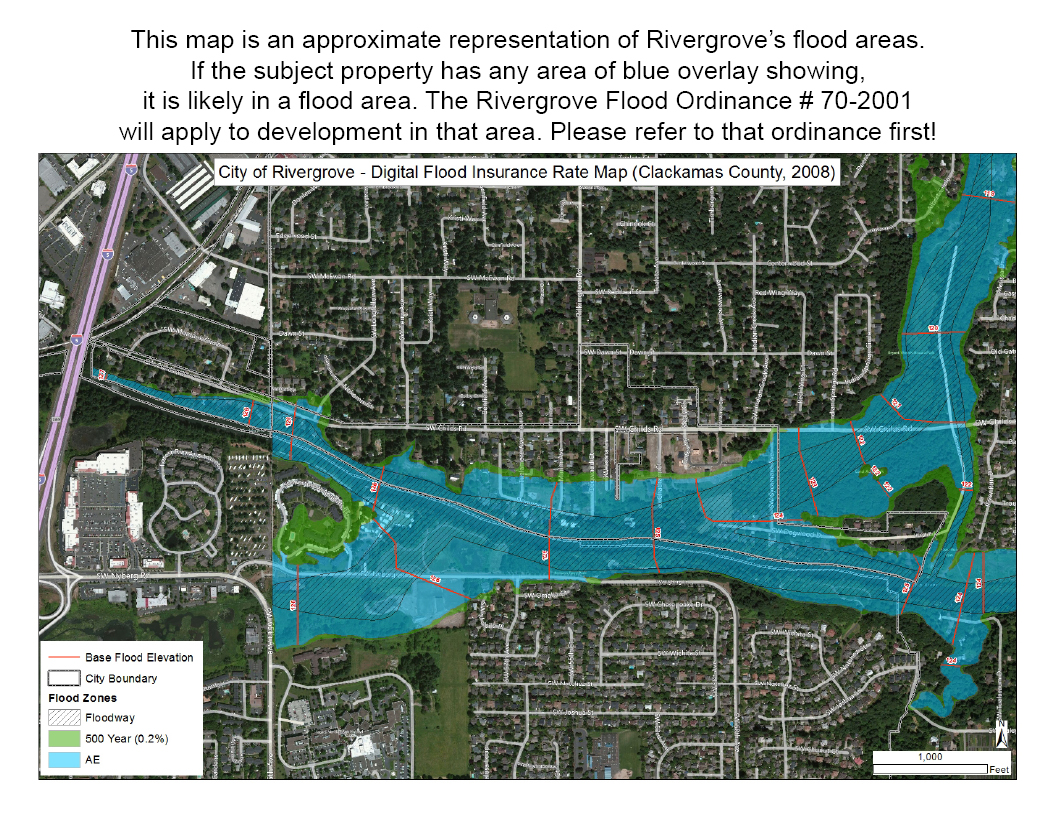
Are you in the floodplain?

flooD ordinance #70-2001
Please check the Rivergrove Flood Map first before consulting this ordinance, to see if the property is in a designated flood area. Flood regulations are very difficult to understand, so if you are planning to dig, build, or cut trees on a lot that is partially or completely blue on the flood map, please contact the City Manager for clarification.
